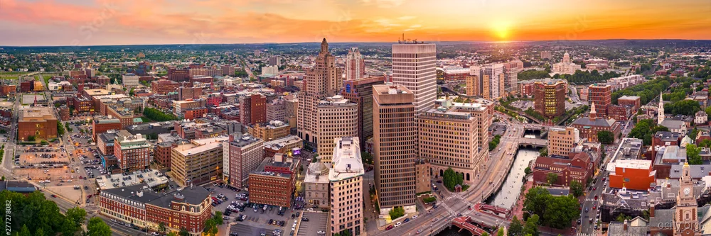
Neighborhood research guide

Where to Live in
Providence

From central districts to quieter residential areas, use this guide to build a Providence shortlist, then verify the exact address and current conditions.

Providence Fast Facts

City home-price reference
$578k
City 1BR rent reference
$1,398
City violent-crime reference
456/100k
Population
190,791

Address-level verification workflow

Research a Providence, RI neighborhood without guessing

The editorial guide below can help build a shortlist, but rents, home values, safety, schools and travel times can differ by block and change quickly. Complete these checks before signing or buying.

Verify the exact home

Check the current listing, lease terms, deposits, utilities, insurance and recurring fees. A citywide median is not a property quote.

Check official local safety data

Use the local police or open-data portal for the exact address and relevant time period. Citywide rates cannot prove block-level risk.

Confirm school boundaries

District and attendance boundaries can change. Verify the exact address with the district before relying on a school assignment.

Test the real commute

Travel the route at the hours you would use it and include parking, transfers, tolls and weather—not only an off-peak estimate.

Model the complete monthly cost

Combine housing, transportation, taxes, insurance, childcare and debt. Neighborhood fit depends on the household, not a universal winner.

Visit before deciding

Walk the area during daytime and evening, check noise and services, and speak with qualified local professionals where appropriate.

Reviewed local sources

Verify a Providence address with official tools

These links are owned by local government, public safety, transit or school organizations. Use the exact address and current date range. An incident map is not a prediction, a nearby school is not proof of assignment, and a route map is not a commute guarantee.

The guide’s prices, ranges, walkability, school context and commute estimates are directional editorial snapshots, not live quotes. Markets and services change; verify the current property, route and assignment before deciding.

Source registry reviewed 2026-07-19.

Boundary and planning check

U.S. Census Bureau

Geocode the exact address and compare it with the Census municipal/place boundary for Providence city, Rhode Island. Do not substitute Providence County, a ZIP Code, or a nearby census-designated place for the City of Providence boundary.

Open U.S. Census Bureau TIGERweb

Reported-incident check

City of Providence

Use the portal's public-safety or police-incident data and filter/map records against the exact address or coordinates. Confirm the dataset's reporting period, geography, and whether incident locations are generalized or withheld for privacy.

Open Providence Open Data Portal

Transit and commute check

Rhode Island Public Transit Authority

Enter the exact address in RIPTA's trip-planning and route tools, then verify the nearest stops, walking path, route direction, service days, and current schedules; service can cross Providence municipal boundaries.

Open RIPTA

School-assignment check

Providence Public School District

Verify the exact residential address with the district's enrollment or student-assignment staff before relying on a school assignment. Attendance areas, school choice, charter enrollment, and transportation eligibility may differ from simple proximity to a school.

Open Providence Public School District

Local Areas to Research

Editorial scope. The guide preserves local observations and directional ranges for comparison. Prices, commute conditions, walkability, school context and reported incidents can change or vary by block, route and date. Treat the figures as an editorial snapshot—not a live quote or guarantee—and verify the exact address with current primary sources.

Best Neighborhoods in Providence, RI (2026 Guide)

Read this as a directional 2026 editorial snapshot, not a live market report. Providence changes block by block: confirm the exact unit, parking arrangement, lease terms, school process, transit schedule, and current reported incidents before applying or making an offer.

Providence in 2026: Change Without the Sales Pitch

Providence’s redevelopment story is uneven rather than citywide. The Woonasquatucket River Greenway and surrounding former industrial areas have added cycling access and attracted residential, commercial, and maker-space activity in selected corridors. Construction status, public access, and nearby noise conditions vary by address.

The I-195 relocation opened redevelopment parcels and new street connections around downtown, the Jewelry District, Fox Point, and the riverfront. It is not a single completed “land bridge” that reconnects the entire East Side to the water, but it has materially changed the former highway area.

Brown and RISD remain major institutional and housing-demand influences. Hybrid commuters and households comparing Providence with Greater Boston also shape demand, especially near downtown, Providence Station, and established restaurant districts. Residents may describe redevelopment pressure in parts of Olneyville, the West End, Upper South Providence, Washington Park, and around Cranston Street as gentrification; that term reflects real concerns about affordability and displacement as well as renovation activity, and it should not be used as a forecast of future values.

Federal Hill remains a dense dining and nightlife district centered on Atwells Avenue and nearby streets. Olneyville combines legacy industrial, residential, restaurant, and arts-oriented uses, with development interest varying sharply by block. On the East Side, “Hope Village” is a common subarea label rather than a guaranteed official boundary; it generally carries higher housing costs, university influence, and constrained inventory. In southern neighborhoods, some triple-deckers and multifamily properties have been renovated, but building condition and tenancy remain property-specific.

Quick Compare: 2026 Neighborhood Shortlist

Neighborhood Vibe Price Score (vs. $1,398) Best For
Federal Hill Nightlife Industrial High (legacy +25% directional marker) Young Professionals, Foodies
Elmhurst Academic Residential Average (legacy flat directional marker) Grad Students, Value Seekers
Olneyville Hipster Grit Low (legacy -15% directional marker) Artists, First-Time Buyers
Washington Park Upwardly Mobile Low-Mid (legacy +5% directional marker) Families, commuters to Quonset

How to read the table: The retained $1,398 reference and percentage labels are editorial shorthand from the original guide, not a documented market index or calculated rent premium. They do not necessarily reconcile with the one-bedroom examples below and should not be treated as current pricing, a neighborhood median, or a prediction.

Federal Hill

Character, rent, and access

  • Vibe: Nightlife Industrial.
  • Rent check: High. The directional 2026 snapshot retains an expectation of $1,650+ for a renovated one-bedroom, not a live quote or availability guarantee.
  • Walkability and pros: Federal Hill is among Providence’s more walkable dining and nightlife districts, especially near Atwells Avenue, Broadway, and the downtown edge. Atwells Avenue has a notable Italian-American restaurant concentration; claims that it offers the “best” Italian dining in the country are subjective rather than verifiable.
  • Downtown access: WaterFire programming and the downtown riverwalk are reachable on foot from much of Federal Hill, but a “10-minute walk” applies only to favorable eastern-edge addresses and routes. Many addresses will be closer to a roughly 15-to-30-minute walk, particularly in event crowds or winter conditions.
  • River connection: The Providence River Pedestrian Bridge and downtown riverwalk are east of Federal Hill and are generally reached through downtown; they are not a direct amenity from every Federal Hill block.
  • Public space correction: Cathedral Square is an existing downtown plaza, not a new Federal Hill park development. Its programming, landscaping, and surrounding activity can change.

Trade-offs and local checks

  • Noise: Apartments facing Atwells Avenue or immediately adjacent nightlife uses may experience significant Friday and Saturday noise. Visit the exact block at evening and late-night hours before signing.
  • Parking: Street parking can be constrained, particularly around dining destinations and events. Off-street or garage parking materially changes the experience; do not rely on a fixed “30-minute” parking estimate.
  • Reported incidents: Do not describe the neighborhood as uniformly safe or unsafe. Review current Providence Police reported-incident information for the immediate address and walking route, rather than relying on a neighborhood-wide label.
  • Best fit: Young professionals and diners who want a walkable social district and can accept nightlife activity, parking constraints, and higher rents.
  • Local insight: Try DePasquale Plaza—not “DePasquale Avenue”—on a weekday evening for a generally calmer version of the district than a peak weekend night. The original guide’s Brewed Awakenings recommendation should be treated as a current-location check rather than a confirmed Federal Hill amenity; coffee businesses and hours change.

Elmhurst

Character, rent, and campus context

  • Vibe: Academic Residential.
  • Rent check: Average. The retained directional 2026 range is roughly $1,300–$1,450, not a live one-bedroom quote.
  • Space and housing mix: Elmhurst can offer larger multifamily layouts and quieter residential streets than compact downtown or College Hill housing, although unit size, maintenance, parking, and ownership structure vary widely.
  • Campus access correction: Providence College is generally closer to Elmhurst than Brown or RISD. Brown, RISD, and College Hill are a longer, hillier trip from much of Elmhurst and may be more practical by bike, bus, or car than as a routine walk.
  • Retail: The neighborhood has a thinner retail concentration than Federal Hill or Thayer Street. Residents may drive, bike, or take transit toward North Main Street, Thayer Street, or downtown for a broader errand run.

Trade-offs and local checks

  • Hills: Downtown walking can be strenuous, particularly in winter or when carrying groceries.
  • Parks correction: There is no known “Elmhurst Extension” of the Blackstone Park system. Blackstone Park is on the East Side, not an Elmhurst neighborhood amenity. Dog owners should map the nearest actual park, sidewalk route, and pet rules from the exact address.
  • Rent rationale: The original claim that rents stayed lower because the area is “mostly owner-occupied triple-deckers” is not established here. Treat housing tenure and rent differences as property-level research questions.
  • Best fit: Graduate students, Providence College affiliates, and households seeking a more residential setting without the undergrad nightlife concentration near College Hill.
  • Local insight correction: Craigston Street and Hartford Avenue are not an Elmhurst intersection, so they should not be used as an Elmhurst search locator. New Harvest’s operating locations should also be confirmed before treating it as a nearby Elmhurst coffee stop.

Olneyville

Character, rent, and central location

  • Vibe: “Hipster Grit” is retained as the original shorthand, but a more useful description is a mixed industrial-residential district with longstanding businesses, arts activity, newer residential projects, and uneven block conditions.
  • Rent check: Low. The retained directional 2026 example is $1,100–$1,250 for one-bedrooms, not a live quote. “Hurry” language is intentionally removed: availability, condition, and lease terms require current verification.
  • Access: Olneyville is centrally placed for cycling or driving toward downtown, Federal Hill, and the West End. Route comfort depends on the specific street, bicycle infrastructure, traffic, and time of day.
  • Food: Olneyville Square remains known for longstanding food businesses, including hot wieners at Olneyville New York System. Confirm current hours before visiting.

Trade-offs and local checks

  • Industrial conditions: Valley Street and other industrial or commercial edges may bring truck traffic, deliveries, train-related noise, odors, or late operating hours. Tour the unit during the times you expect to be home.
  • Reported incidents: The original comparison stating that car break-ins are higher here is not retained as a neighborhood-wide fact. Check Providence Police reported incidents by date range, category, and exact walking or parking route; reported incidents do not predict a future event.
  • Best fit: Artists, service-industry workers, and renters or first-time buyers willing to compare building condition, street activity, and transit access carefully.
  • Local insight: Look beyond a single “hot” block. Manton Avenue, Hartford Avenue, Olneyville Square, and nearby side streets can differ substantially. Manton and Chalkstone references may extend across neighborhood edges, so confirm the parcel’s municipal and neighborhood designation rather than assuming one continuous renovation zone.
  • Buyer caution: The original three-year holding-horizon equity claim is not supportable and is not a recommendation. New construction or rehabilitation near Valley Street and the Woonasquatucket corridor can be worth monitoring through permits and planning records, but it does not imply predictable value growth. River proximity should also prompt a flood-zone, insurance, drainage, and building-condition review.

Washington Park

Character, rent, and southbound commuting

  • Vibe: Upwardly Mobile.
  • Rent check: Low-Mid. The retained directional 2026 range is $1,250–$1,400, not a current quote or neighborhood median.
  • Community and outdoor context: Washington Park offers a more residential south-Providence setting with local parks, waterfront/Fields Point access, and neighborhood institutions. The original description of a very large park with ponds and summer concerts more closely fits Roger Williams Park, which is in the South Elmwood/Roger Williams Park area rather than Washington Park proper. It can still be a regional recreation destination, but it is not an automatic walkable Washington Park anchor.
  • Broad Street: Broad Street has commercial uses, restaurants, and services, but individual cafés and bakeries can open, close, or relocate. Confirm the present block and operating hours.
  • Driving context: Washington Park’s southern location can be convenient for car trips toward T. F. Green Airport in Warwick and Quonset Business Park in North Kingstown. Actual travel times depend on I-95, Route 1, bridge conditions, shift timing, weather, and destination parking.

Trade-offs and local checks

  • Street connections: Washington Park is not simply “isolated,” but some trips to downtown cross highway, industrial, or wide-arterial environments that may feel less comfortable on foot or by bike.
  • Geography correction: Post Road is primarily a Warwick corridor, not a Washington Park street crossing. Broad Street and other nearby arterials deserve an in-person crossing, sidewalk, lighting, and traffic-speed check.
  • Transit: RIPTA service in the broader area can be useful, but route frequency, transfer needs, and evening/weekend schedules must be checked for the exact stop and travel time.
  • Best fit: Households seeking more residential space, possible yard access, and a southbound driving orientation toward the airport or industrial employment centers.
  • Local insight: Streets off Prairie Avenue near local park space may feel quieter than busier corridors, but confirm traffic, parking, and nighttime conditions block by block. The original Sisty’s-on-Broad suggestion requires a current business and exact-location check; Broad Street locations may fall outside the neighborhood depending on the address.

Exact-Address Verification Before You Rent or Buy

No exact property address was supplied for this guide, so no parcel, incident, transit, or school assignment can be verified here. Complete the following checks for every candidate address and unit number.

Verify the official location and boundaries

  1. Confirm the property’s municipality, parcel, ward, and official planning/GIS designation through the City of Providence’s parcel and planning-map resources.
  2. Do not rely solely on a listing’s neighborhood label. Terms such as “East Side,” “Hope Village,” “Federal Hill,” “West End,” and “Olneyville adjacent” can be used differently by residents, brokers, and advertisers.
  3. For addresses near city lines—including portions of Broad Street—confirm whether the property is in Providence, Cranston, North Providence, or another municipality before evaluating schools, taxes, police reporting, and services.

Review reported incidents, not neighborhood stereotypes

  1. Use Providence Police reported-incident resources for the exact address, adjacent blocks, parking area, and intended walking route.
  2. Record the search date, date range, incident categories, and search area. Compare like-for-like ranges for every address.
  3. Distinguish reported incidents from convictions, calls for service, and future risk. A map result is context for questions and site visits, not a guarantee about safety.

Test transit and real travel patterns

  1. Identify the nearest RIPTA stops, route numbers, scheduled frequency, transfers, final evening trip, and weekend service for the actual unit.
  2. For Boston rail commuting, test the trip from the property to Providence Station, then compare MBTA and Amtrak schedules, fares, parking, and return-trip timing.
  3. Drive or ride the route at the time you would actually travel. For airport and Quonset trips, test I-95, Route 1, bridge approaches, and destination parking rather than assuming a south-side address avoids congestion.

Obtain school assignment in writing

  1. Ask Providence Public School District Enrollment and Registration to confirm the current options, assignment process, transportation eligibility, program availability, grade-level capacity, and deadlines for the exact address.
  2. Providence families should not assume that living in a named neighborhood guarantees one particular public school. Assignment can depend on address, grade, program, capacity, enrollment rules, and current district policy.
  3. Review Rhode Island school-report information as context, but do not treat district-wide or neighborhood-level commentary as an individual child’s assignment or educational outcome.

Write a direct address-to-address comparison

Exact-address factor Candidate Address A Candidate Address B Record or question to keep
Official municipality, parcel, ward, and neighborhood label City GIS/planning confirmation and date checked
Rent or purchase terms Unit size, utilities, parking, fees, lease length, repair obligations
Street activity and parking Daytime, evening, and weekend visit notes
Reported incidents Same source, date range, categories, and map area
RIPTA and rail access Stop distance, schedule, transfers, last return trip
Work commute Actual test time to downtown, Boston, T. F. Green, or Quonset
School assignment Written district response for grade and program
Building and environmental conditions Noise, flood zone, drainage, lead, heating, pests, maintenance history

Decision Pathways by Household and Traffic Pattern

Families: Washington Park or Elmhurst, with school confirmation first

Washington Park and the residential edge of Elmhurst remain the two strongest matches in this shortlist for households prioritizing more space, quieter blocks, or potential yard access. Washington Park can make sense for southbound driving and access to local recreation; Elmhurst may suit households seeking a residential setting closer to Providence College and north-side errands.

Neither neighborhood automatically “wins” on public schools. Confirm assignment and transportation for the exact address before treating school access as a reason to choose one over the other. Federal Hill can work for families who value walkability, but nightlife noise, parking, and late activity are meaningful trade-offs.

Downtown, Boston Financial District, and Hybrid Commuters: Compare Federal Hill With Providence Station Access

Federal Hill is a practical starting point for people who want downtown access, restaurants, and a walkable social life. From its eastern edge, Providence Station may be reachable within roughly 15 minutes on foot; from many other addresses, the walk can be materially longer and hillier. Test the actual route with work gear, in poor weather, and after a late train.

For Boston commuters, the MBTA can be useful, including some weekend service, but schedules and service patterns change. Compare a Federal Hill address with a closer-to-station alternative if train reliability, early departures, or late returns are central to the decision.

Airport, Quonset, and Southbound Drivers: Washington Park as a Route-Test Candidate

Washington Park is worth comparing for workers driving toward T. F. Green Airport, Warwick, or Quonset Business Park because of its south-Providence position. It does not bypass all bridge or highway traffic. Test the actual shift-time route, including I-95 merging, Route 1 conditions, weather exposure, and parking at the destination.

Artists, Service Workers, and Lower-Entry Buyer Research: Olneyville With Block-Level Due Diligence

Olneyville remains the shortlist’s lower-rent directional option and may appeal to artists, service-industry workers, and first-time buyers seeking central access and mixed-use character. Compare exact blocks near Olneyville Square, Manton Avenue, Hartford Avenue, and Valley Street rather than relying on a neighborhood-wide reputation.

For buyers, evaluate permits, unit condition, rental history, lead compliance, flood exposure, insurance, tenant obligations, and financing terms. Development along the Woonasquatucket corridor may be relevant context, but it is not a promise of rapid appreciation, future waterfront premiums, or equity on any timeline.

Housing Market

City home-price reference$578k
City price / SqFt$258
City rent (1BR)$1,398
City rent (2BR)$1,693

Citywide reference fields are not current quotes for a neighborhood or property.

Neighborhood Decisions

Validate the full Providence move